 Mnt Batur Jeep Tours
Home › Guides › How High Is Mount Batur? Height, Eruptions and the Jeep Sunrise Point
How High Is Mount Batur? Height, Eruptions and the Jeep Sunrise Point
Mount Batur height is 1,717 metres (5,633 feet) above sea level, but a jeep sunrise tour stops lower, at a point the listings put at about 1,365 m to about 1,400 m. This page covers the climb, the 6:00 AM temperature, the eruption record and which Mount Batur jeep tours stop where.
Quick answer Height in one minute
Mount Batur is 1,717 metres (5,633 feet) above sea level, but jeep sunrise points sit lower, at about 1,365 m to about 1,400 m. One tour drives to the halfway point and adds a guided walk of up to 45 minutes to the summit. PVMBG lists the volcano at Level I (Normal) and the last recorded eruption was in 2000.
Key takeaways
- The Private Jeep Adventure with Black Lava lists its sunrise point at about 1,365 m above sea level.
- The Private Classic 4x4 Sunrise Jeep lists a 30 minute off-road ride to a sunrise point at about 1,400 m.
- The Jeep Halfway and Walk to the Summit adds a guided walk of up to 45 minutes from the jeep drop to the summit.
- At 6:00 AM the lava fields average 16.3°C (61°F) in August and 18.5°C (65°F) in December, so bring a jacket for the Private Sunrise Jeep with Lounge Breakfast.
How High Is Mount Batur in Metres and Feet?
Mount Batur stands about 1,717 metres (5,633 feet) above sea level.
The Bangli regency tourism office publishes 1,717 m as the summit height.
The Summit and the Cone Above the Lake
Mount Batur is about 1,717 metres high, which is 5,633 feet. That is the summit. It is not the point where a jeep stops for sunrise. Inside the caldera the active cone is a stratovolcano about 700 metres tall, rising above Lake Batur. Lake Batur is about 7.5 km long and 2.5 km wide.
Mount Batur sits in a double caldera that formed after eruptions about 29,300 and 20,150 years ago. Mount Agung is the island's highest point, and Intrepid Travel gives its summit as 3,000 metres.
Height Figures at a Glance
This table sets the published summit height of 1,717 m next to the sunrise points that the tour listings give, so you can see what each morning involves.
| Measure | Figure | What it means on the day |
|---|---|---|
| Summit above sea level | 1,717 m (5,633 ft) | Reached on foot, or on the halfway-and-walk tour |
| Active cone above Lake Batur | about 700 m | The cone you look at from the jeep points |
| Sunrise point, Private Jeep Adventure with Black Lava | about 1,365 m | Reached by jeep, no climbing |
| Sunrise point, Private Classic 4x4 Sunrise Jeep | about 1,400 m | A 30 minute off-road ride from the pickup |
| Walk start, Jeep Halfway and Walk to the Summit | halfway up | Guided walk of up to 45 minutes to the summit |
Sources: Bangli Tourism Office, Indonesia Ministry of Energy (ESDM), Toya Devasya.
How Much Elevation Do You Gain When Hiking Mount Batur?
A jeep moves the start to about 1,400 m on the slope below the 1,717 m summit, and the jeep-only tours here include no hiking.
The gain depends on where you start walking, and a jeep moves the start point a long way up the slope.
What the Jeep Takes Off the Climb
The Private Jeep Adventure with Black Lava lists its sunrise point at about 1,365 m and, on its optional hike, a jeep ride to about 1,400 m before a 45 minute walk to the summit. The Private Classic 4x4 Sunrise Jeep stops at about 1,400 m. The Jeep Halfway and Walk to the Summit drives to the halfway point, then walks up to 45 minutes.
On a jeep-only tour you step out at the viewpoint at about 1,365 m or about 1,400 m. Only the walking options ask for legs.
Source: Bangli Tourism Office.
How Long Does It Take to Walk Up Mount Batur?
On the Jeep Halfway and Walk to the Summit tour the guided walk from the jeep drop to the summit takes up to 45 minutes.
A walk from the jeep drop is far shorter than a walk from the bottom, and the tour listings give the figure.
Walking From the Jeep Drop
The Jeep Halfway and Walk to the Summit costs $37.97 per person. The price covers the jeep to the halfway point, a guided walk of up to 45 minutes to the summit, breakfast at the top and all fees. Hot springs come only on its Best Combination option. The listing runs 10 hours, takes groups of up to 15 and books ages 4 to 65. A head flashlight is provided.
Two more listings carry a 45 minute walk as an option. The Private Jeep Adventure with Black Lava offers a Jeep + Lava + Hike To Summit option, and the Private Jeep with Hot Spring Packages offers a Jeep + Hot Spring + Hike option.
Walking From the Bottom
Batur Natural Hot Spring publishes a private sunrise trek that starts at 4:00 AM, reaches the summit for sunrise at 6:15 AM and descends at 8:30 AM. NOAA puts sunrise at Mount Batur at 5:48 AM in mid-November and 6:34 AM in mid-July.
Sources: Batur Natural Hot Spring, NOAA Global Monitoring Laboratory.
Tours That Fit
Three listings: no climbing, a ride to about 1,400 m, and a walk to the summit.
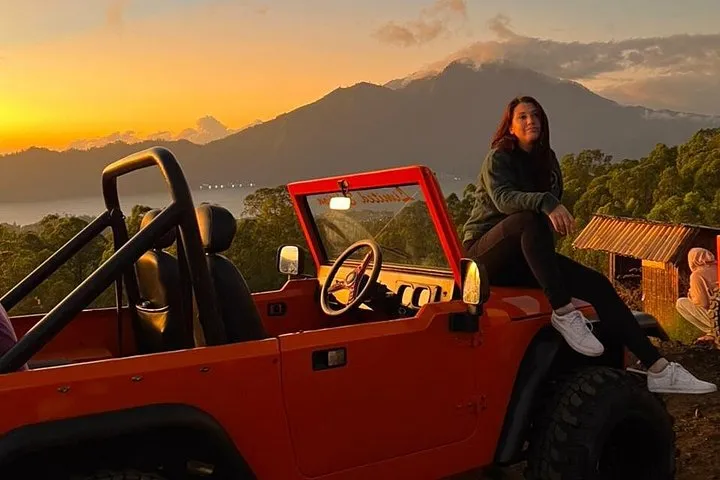 from $21
Black lava route
Mount Batur Jeep Adventure
Biggest menu of combos on one listing, from jeep only to hot spring, ATV, rafting or a summit hike.
Check Availability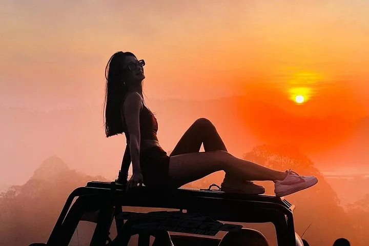 from $30
Roof seats
Mount Batur Jeep Sunrise Tour
Jeep sunrise for all ages, even infants, with an all inclusive hot spring combo and hotel pickup.
Check Availability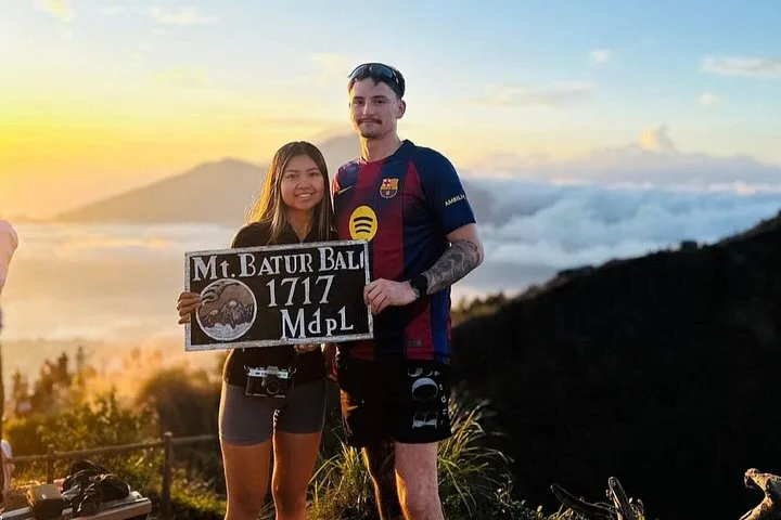 from $37.97
Jeep plus summit walk
Mount Batur Jeep With Halfway Trekking to Summit
Jeep to halfway then a 45 minute hike to the summit, the only listing here that reaches the crater top.
Check AvailabilityIs Mount Batur Hard to Climb?
The jeep-only tours are listed as easy with no hiking, and the walking option is listed as moderate with up to 45 minutes on foot.
How hard the morning is depends on the tour you pick.
Jeep Only: Easy
The Private Sunrise Jeep with Lounge Breakfast lists the day as easy, with no hiking and a bumpy 4WD ride on volcanic terrain. The Shared Sunrise Jeep from Ubud lists no hiking either, because the jeep takes you to the viewpoint. The Private Classic 4x4 Sunrise Jeep adds a 30 minute off-road ride to the sunrise point.
Jeep and Walk: Moderate
The Jeep Halfway and Walk to the Summit is rated moderate. You ride to the halfway point and then walk up to 45 minutes on foot with a guide. Ages 4 to 65 are bookable.
The Jeep Halfway and Walk to the Summit is not recommended for spinal injuries, poor cardiovascular health or pregnancy. The Shared Sunrise Jeep from Ubud is not suitable for anyone over 70.
Source: Bangli Tourism Office.
How Cold Is It on Top of Mount Batur?
On the lava fields the 6:00 AM temperature runs from 16.3°C (61°F) in August to 18.5°C (65°F) in December, and the summit is higher and cooler.
The 6:00 AM column is the one to read, because sunrise starts in the coldest hour.
Monthly Temperature and Rain
This table gives ERA5 climate averages for 1995-2024 at the Mount Batur lava fields: the daily high, the daily low, the temperature at 6:00 AM and the rain in millimetres for each month.
| Month | High | Low | 6:00 AM | Rain |
|---|---|---|---|---|
| January | 23.5°C (74°F) | 18.1°C (65°F) | 18.3°C (65°F) | 469 mm |
| February | 23.5°C (74°F) | 18.1°C (65°F) | 18.3°C (65°F) | 463 mm |
| March | 23.8°C (75°F) | 18.1°C (65°F) | 18.3°C (65°F) | 418 mm |
| April | 23.8°C (75°F) | 18.1°C (65°F) | 18.3°C (65°F) | 279 mm |
| May | 23.9°C (75°F) | 17.8°C (64°F) | 18.0°C (64°F) | 127 mm |
| June | 23.6°C (74°F) | 17.2°C (63°F) | 17.5°C (63°F) | 80 mm |
| July | 23.4°C (74°F) | 16.5°C (62°F) | 16.7°C (62°F) | 59 mm |
| August | 24.1°C (75°F) | 16.1°C (61°F) | 16.3°C (61°F) | 32 mm |
| September | 25.4°C (78°F) | 16.6°C (62°F) | 16.7°C (62°F) | 42 mm |
| October | 26.0°C (79°F) | 17.4°C (63°F) | 17.6°C (64°F) | 120 mm |
| November | 25.1°C (77°F) | 18.2°C (65°F) | 18.4°C (65°F) | 289 mm |
| December | 23.9°C (75°F) | 18.3°C (65°F) | 18.5°C (65°F) | 444 mm |
What to Wear
The lava fields lie below the summit, so the summit is cooler than the table shows. The Private Sunrise Jeep with Lounge Breakfast lists a warm jacket, sturdy shoes and a change of clothes for the hot spring. August is the driest month at 32 mm and January the wettest at 469 mm.
Sources: Copernicus ERA5, NOAA Global Monitoring Laboratory.
When Was the Last Eruption of Mount Batur and Is It Safe to Visit?
PVMBG lists Mount Batur at Level I (Normal), and the last recorded eruption was in 2000.
Mount Batur is still classed as active, so the record matters for anyone booking a pre-dawn jeep.
The Eruption Record
Bangli tourism records about 30 eruptions between 1804 and 2000. The largest was in 1926 and destroyed Pura Ulun Danu Batur and Batur village. The 1963 eruption left the black lava fields that jeep tours cross today. The last recorded eruption was in 2000.
The PVMBG MAGMA Indonesia page lists Mount Batur at Level I (Normal), the lowest of four levels. MAGMA describes Level I as fluctuating but showing no significant increase in activity. It lists 0 volcanoes at Level IV, 3 at Level III, 24 at Level II and 42 at Level I.
Eruption Prediction and Your Booking
No official body publishes a date for the next eruption. The UK government warns that volcanoes can erupt without warning and that exclusion zones can change at short notice. Canada's advice counts 129 active volcanoes in Indonesia and notes that ash clouds can disrupt air travel, including on Bali.
The Private Jeep Adventure with Black Lava, the Private Classic 4x4 Sunrise Jeep and the Jeep Halfway and Walk to the Summit all list free cancellation up to 24 hours in advance. The level can change, so check MAGMA the day before.
Sources: PVMBG MAGMA Indonesia, Bangli Tourism Office, Toya Devasya, UK FCDO Indonesia Travel Advice, Government of Canada travel advice.
What Can You See From the Mount Batur Sunrise Point?
You see the cone of Mount Batur, Lake Batur, Mount Abang and the 1963 black lava fields.
The jeep points sit at about 1,365 m to about 1,400 m.
From the Jeep Point and the Summit
The Private Classic 4x4 Sunrise Jeep lists the 1963 black lava field after the sunrise point. The Shared Sunrise Jeep and Hot Spring Option lists a viewpoint over Mount Batur and Lake Batur, and its hot spring looks over Lake Batur and Mount Abang. From the summit at sunrise, the Four Seasons Sayan trek page lists Mount Abang, Mount Agung, the island's east coast and as far as Mount Rinjani on Lombok.
UNESCO certified the Batur caldera as a Global Geopark in 2012. The free Batur Volcano Museum south of the mountain is open daily 9:00 AM to 4:00 PM.
Sources: Indonesia Ministry of Energy (ESDM), Indonesia Ministry of Energy (ESDM), Toya Devasya.
Mount Batur Height Questions
How tall is Mount Batur in feet?
Mount Batur is 5,633 feet above sea level. The Private Jeep Adventure with Black Lava stops lower, at about 1,365 m.
What is the height of Mount Batur from base camp?
The listings give the height of the sunrise point rather than a base camp. The Private Classic 4x4 Sunrise Jeep lists about 1,400 m above sea level.
Do you have to climb to see the sunrise at Mount Batur?
No. Jeep-only tours drive to the sunrise point, and the Jeep Halfway and Walk to the Summit is the one that adds up to 45 minutes on foot.
When was the last eruption of Mount Batur?
The last recorded eruption was in 2000. The Private Jeep Adventure with Black Lava lists free cancellation up to 24 hours in advance.
More Guides
- Batur Natural Hot Spring After a Mount Batur Jeep Tour: Tickets and Pools
Batur Natural Hot Spring in 2027: water stays at 38 to 40°C and the regular ticket is IDR 200,000 per adult. See the pools, then compare tours.
- Black Lava Batur: The 1963 Lava Fields on a Mount Batur Jeep Tour
See the 1963 black lava fields by 4WD jeep in 2027, from $21 on private listings. Find which tours stop there, then compare tours.
- Christmas in Bali 2026: A Sunrise Jeep on Mount Batur
Christmas in Bali 2026: 25 December is a national holiday and sunrise at Mount Batur is 6:00 AM. See the jeep options, then check dates.